When SWW faced EDDC’s scrutiny committee recently, Waterfit Live was claimed to be the answer to most councillors’ questions.
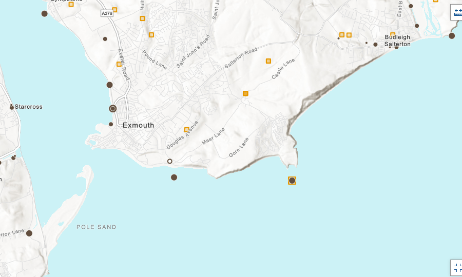
This section of this morning’s South West Water’s Waterfit Live map shows three active discharges in Exmouth, Sandy Bay and Budleigh. Locals know there are more potential sites than these.
Below, for comparison, is the Rivers Trust map showing the actual locations of combined sewage overflows (brown spots) at similar scale but in much greater detail.
Surely we need to know from SWW exactly which outfall has spilled, not a generalised “blob”?
WaterFit Live

Rivers Trust map of existing outfalls